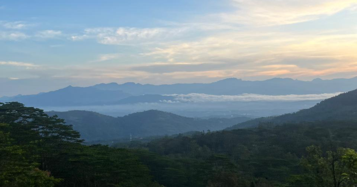
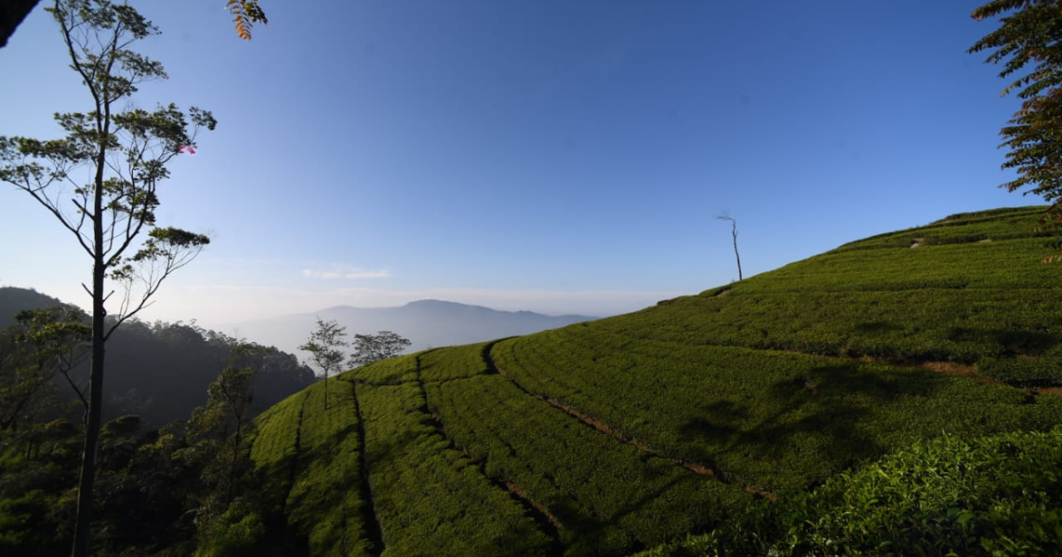
A haven of tranquility, scenic beauty and biodiversity, Hanthana is enveloped by the undulating Hanthana Mountain Range which is graced with Sri Lanka’s iconic tea plantations. Hanthana is the adventurous city sister of Kandy, offering a variety of hikes and exciting excursions for thrill seekers. The Hanthana Mountain Range offers a diverse network of hiking trails, ranging from gentle walks through tea plantations to more challenging ascents of its peaks. The region is a wonderland for fitness fans, high altitude picnic lovers, and content creators seeking that ultimate photo of the region’s stunning sunrise and sunsets.
Uragala Mountain Peak
Uragala appears prehistoric with its bulging rock outcrops over the tea fields, a landmark of the Hanthana Region. The four-hour return hike takes you up a semi-steep incline through lower level tea fields, shaded rocky sections and at the halfway point you reach a grassy clearing with panoramic views over Galaha and toward Peredeniya. It’s recommended to start the climb early and catch the sunrise as you reach the half way point. Catching the pink hued sunrise over the lush green highland tea is an unbeatable experience.
After a short picnic break, continue up further to the exposed rock section of the climb. It can get very windy up the top, so steady feet and dry weather conditions are a must! When you make the final rocky ascent you will find yourself at the highest peak in Hanthana. As the morning mist clears, take in the stunning 360 degree views across the Central Highlands. The peak is a photographer’s delight, offering unique photo opportunities on the rock, out to the hills and captures of the Uragala wildlife and gliding raptors above.
For the more eager hikers not ready to return home, a trail connects Urgala to Katusu Konda, allowing an extended two-peak hike.
Distance: 4.2km
Average Duration: 2 hours
Region: Hanthana Mountain Range, near Kandy
Elevation Gain: 1,200 meters (3,800 feet)
Peak Elevation: 1,348m (4,134 feet)
Difficulty: Moderate – Hard
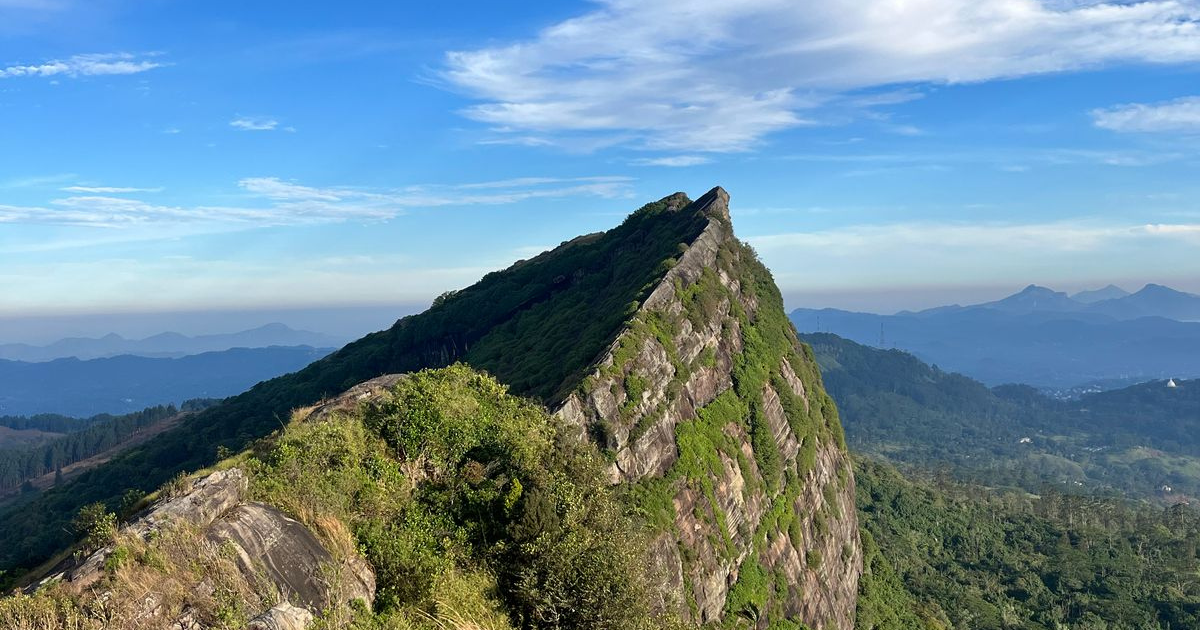
Katusu Konda Mountain Peak
Katusu Konda Mountain’s spine-like edges are reminiscent of a lizards back, a direct translation of the mountain name. The initial path meanders through lush greenery before narrowing as it ascends towards the summit’s dramatic, razor-edge. This final stretch offers a thrilling experience with steep drops on either side and strong winds often sweeping across the peak. Reaching the top demands caution, especially in wet conditions, but the reward is an unparalleled sense of accomplishment amidst the raw beauty of Sri Lanka’s highlands.
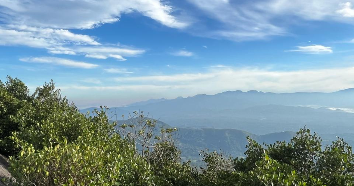
From the summit of Katusu Konda, hikers are treated to breathtaking 360-degree panoramas. On a clear day, the majestic Knuckles Mountain Range dominates the horizon, alongside views of Kandy City with its iconic landmarks and the sprawling University of Peradeniya campus. Distant landmarks like Monaragala, Alagalla, and Hunnasgiriya can also be spotted, creating a stunning tapestry of the island’s diverse landscapes. The interplay of mist, sunlight, and the endless rolling green hills crafts a truly magical atmosphere.
Distance: 7-8 km
Duration: 3-4 hours
Region: Hanthana Mountain Range, near Kandy
Elevation Gain: 520 meters (1706 feet)
Peak Elevation: 1,322 meters (4,337 feet)
Difficulty: Moderate – Hard
The Pekoe Trail
The awe-inspiring Pekoe Trail is a 22 stage, 300km trail that navigates through Sri Lanka’s highland and tea plantations, recently named one of Time Magazine’s World’s Greatest Places of 2025, and in our opinion, it is an unmissable experience for hiking and trekking enthusiasts.
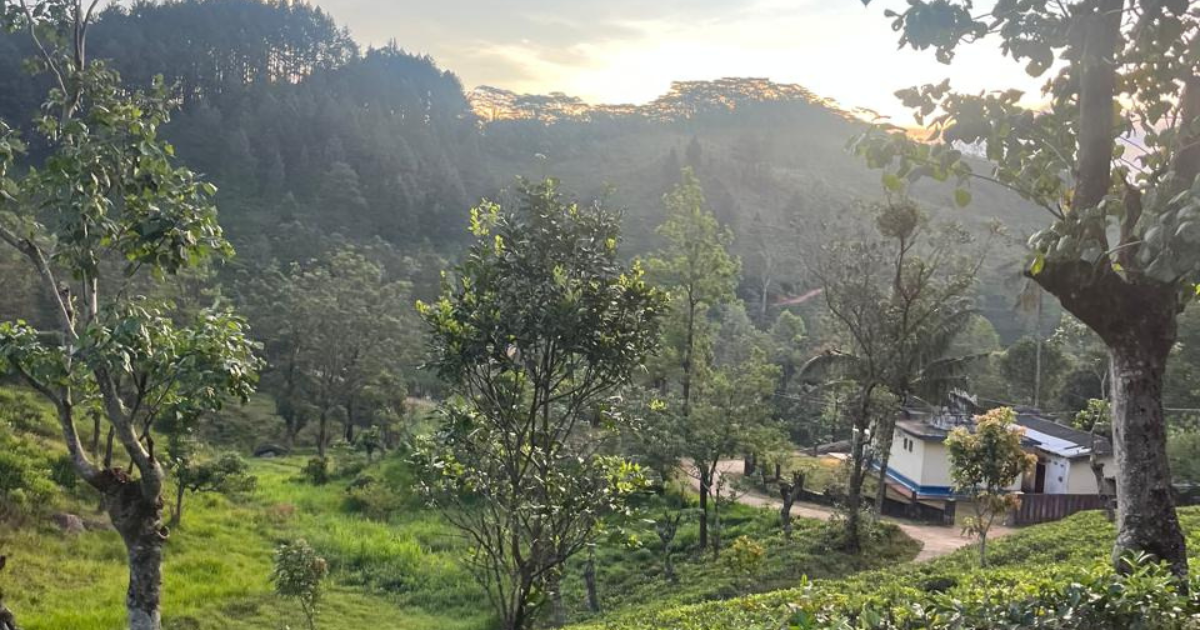
With so many options for hikers and trekkers it’s not hard to find hotels in Hanthana, Kandy that are within close proximity to a stunning mountain hike or trek through the working tea plantations and their bustling traditional villages.
Dendrobium House is the perfect option for those looking to explore Stage 1 & 2 of The Pekoe Trail, the hotel is located just 4km from the start of the trail and offers a trained inhouse naturalist to help guide hikers through the trail, as well as Defender pick ups and drop offs.
The Pekoe Trail Stage 1
Stage 1 traverses between Hanthana and Galaha, commencing at the historic Ceylon Tea Museum, located on the scenic Hantana Estate and housed in the former Hantana Tea Factory. The museum is a must-see for fans of Ceylon Tea, showcasing historic machinery, literature and a tea cafe with a view out over the trail ahead.
The nearly 13km trail is a blend of nature and culture, as it meanders through verdant tea plantations and colourful villages, around the sugarcane quarantine facility, past temple stupas and kovils, through sections of the lost movie set of the Indiana Jones Temple of Doom and ends with a steeper incline through the pine forest to the Galaha Post Office.
Stage 1 is a relatively easy hike and suitable for adults and kids. There are plenty of view points and shady locations for a picnic break. It is recommended to enlist the services of a Local Guide or a hotel Naturalist to assist in navigation of the stage.
Facts & Figures
Length: 12.84 km (7.98 mi)
Average Duration: 4 hours
People Interactions: High
Region: Hanthana, Kandy
Elevation Gain: 537m (1,762 ft)
Elevation Loss: 470m (1,542 ft)
Maximum Elevation: 1,067 m (3,501 ft)
Points of Interest
Ceylon Tea Museum
Upper Hanthana Church
Sandagiri Maha Stupa
Rathnasiri Wickramanayake National Training Center
Indiana Jones The Temple of the Doom Movie Set
Katusu Konda
Kithulmulla Vilage
Lunuwella Viharaya
Galaha Group Hindu Kovil
Difficulty
Forward: Easy – Moderate
Reverse: Easy – Moderate
The Pekoe Trail Stage 2
The second stage of The Pekoe Trail is a significant section as it starts at Galaha and ends at Loolecondera Estate, the birthplace of Ceylon Tea. It is a more challenging and scenic trail that takes explorers through varying inclines and environments.
The trek commences with a picturesque path leading into the heart of Deltota Estate, where stunning views of the surrounding mountains unfold as you ascend. Passing through the lively hill country town of Deltota, notable for its vibrant market and green mosque. The route continues uphill, entering a shaded old pine forest before joining an old tea estate road that offers breathtaking panoramic vistas near the summit. The journey then passes an abandoned village and a small river, opening into the upper reaches of the historic and well manicured Loolecondera Estate, where James Taylor’s original cottage still stands.
James Taylor was the founding father of the Ceylon Tea industry during British colonial rule. Take the time to walk around the estate and watch the tea pluckers deliver their haul to the weighing stations, discover monuments of a time gone by and endless views across the valley. The final section makes a gradual descent through vibrant tea bushes, impressive rock formations and lush rainforest, concluding at a bridge and a Hindu shrine.
Facts & Figures
Distance: 14.7 km (9.13 mi)
Average Duration: 5 hours
People Interactions: High
Region: Deltota & Galaha
Elevation Gain: 853m (2,799 ft)
Elevation Loss: 510m (1,673 ft)
Maximum Elevation: 1402 m (4,600 ft)
Difficulty
Forward: Difficult
Reverse: Difficult
Points of Interest
Galaha Sri Muththumariamman Kovil
Deltota Group Hindu Kovil
Suduwella Temple
Hulan Elle Rock
James Taylor’s Seat
Konda Gala
James Taylors Cottage
Summer Hut – Loolecondera Tea Estate
Ma Oya “Pool One”
First Tea Plantation Fields in Sri Lanka
Loolacondera Tea Factory
Top Tips for Hiking in Hanthana